Lithic Landscapes and Settlement Patterns: A Cultural Resources Survey of Alamo Lake, La Paz County, Arizona
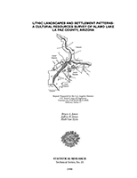
By Bruce A. Jones, Jeffrey H. Altschul, and Ruth Van Dyke
Technical Series 25
182 pp. / 1990
In October and November, 1989, Statistical Research conducted an intensive cultural resources survey of approximately 2,400 acres at Alamo Reservoir under contract to the U.S. Army Corps of Engineers (COE). The field reconnaissance documented 29 archaeological sites consisting of lithic quarries, artifact scatters, trails, rock features, and mining-related activities.
An embedded concept of numerous activities occurring as a consequence of seasonal foraging was apparently utilized by foraging groups practicing a seasonal strategy of limited activities associated with resource extraction. This strategy produces low archaeological visibility and variability in site types.
Prehistoric use of the Alamo Lake region appears to have focused on the major activities of plant procurement as a seasonal aspect of aboriginal groups. Consequential subsistence goals such as game procurement provided the incentive for lithic quarrying at numerous localities focusing on the ridge system 2 km to the south of the Santa Maria River. This quarry complex was a centralized locus of raw materials due to the co-occurrence of high-quality chalcedony and abundant chert outcrops. Cores were reduced for flakes and biracial blank production and rendered into tools and points at localities presently unknown.
Trail systems linked these quarries with important processing and utilization areas within the region, of which Alamo was a small, and as yet little known portion.
Commercial mining in historic times was a frequent activity at Alamo since the 1860s. Stone monuments indicate mining lode claims dating to the period of manganese exploration (1930–1960) in the region. The remains of at least seven such claims were recorded during the 1989 survey. Six of these claims were verified by archival research. One claim could not be located in the Yuma County records. The mining properties located by the field crew dated to the 1950–1956 period.
Fourteen of the 29 sites are considered as potentially eligible for inclusion in the National Register of Historic Places (NRHP). Eight of these sites are considered as a district nomination in addition to the 12 sites previously considered for nomination by Gregory (1988). The remaining six sites could contribute to the research potential of the area and possess good surface integrity.